History is a key subject for a good reason. Thanks to history, you get to learn and discover valuable lessons about the origins of mankind, the changes that the society has gone through, and the different mistakes that were made. Most history is told through textbooks that play a critical role when it comes to learning more about history. But, this is not the only way because OldMapster historical maps are also excellent visual ways to get a glimpse of the distant past.
Table of Contents
What Does Historical Map Show?
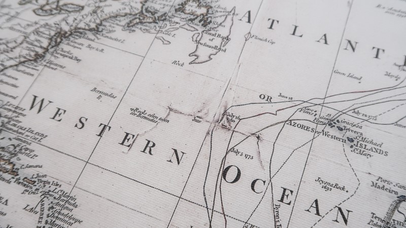
A historical map is available on different subjects. You can find maps that detail the four voyages of Columbus, maps of battles and wars such as World War II and Civil War, and maps showing how borders and territories have changed.
The map’s details and symbols will vary based on its purpose. A map of the voyages of Columbus will show the different regions where he arrived and departed. However, its main feature is the routes and ocean he traveled, often indicated by a dashed or solid line with the voyages represented in different colors.
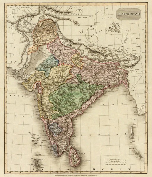
This historical map covers the subcontinent from Tibet to Ceylon (Sri Lanka) and from the mouth of the Indus to the Kingdom of Pegu (Burma or Myanmar)
Among the most interesting types of historical maps are the ones that depict wars or battles. A historical battle map shows the area where the battle took place and the area that every force occupied as well as their movement. The bigger maps of wars like the World Wars often show both sides in different colors. For instance, the countries on the Axis side will be in red while the Allied countries will be blue. These maps also often show movements of the two sides and specific locations of the key battles.
Territory maps reveal the borders of countries and states have changed through the years. United States is a good example of this. For the past 200 years, the open land turned into territories, the territories became states, and there were changes in the boundaries, too. There are also some maps with different pages you can layer, showing how things changed.
8 Notable Early Maps
Here are eight of the most crucial maps that go as far back as cartography’s early history:
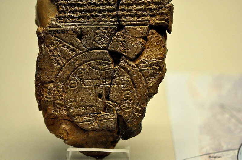
The Babylonian World Map
The earliest known world map in history was scratched on the clay tablets in Babylon’s ancient city sometime around 600 BC. This star-shaped map only measures 5 by 3 inches showing the world as flat disc surrounded by a “bitter river” or ocean. There is an accompanying cuneiform text describing the unknown lands to be occupied by mythological beasts, suggesting that the map reveals actual geographical features and Babylonian cosmology elements.
Babylonian Map of the World
The Cantino Planisphere
Once at the center of a cartographic theft act, the Cantino Planisphere not just depicts Europe, India, and Africa in unprecedented detail because this also stands as among the earliest maps ever known that show the coastlines of the New World territories of Portugal in South America. The map also indicates a tiny grouping of landmasses to the northern part of Brazil that look like Hispaniola, Cuba, and part of American East Coast.
Video: Cantino’s map
The Da Ming Hun Yi Ti
The Amalgamated Map of the Ming Empire or Da Ming Hun Yi Ti of China is among Far East’s earliest surviving world maps drawn on silk that dates as far back as 1389. This map spans the whole Eurasian continent from the Atlantic Ocean to Japan that includes meticulous markings of administrative centers, rivers, and mountain ranges. It is especially notable for how it distorts the sizes of different landmasses.
The Mercator Projection
The renowned Mercator projection used to be staple of the school classrooms all over the world but it was also the topic of considerable controversy and debate. However, the Mercator projection still remained as a fixture of atlases until 20th century when it was denounced to be inaccurate by its critics. While this remains to be used as a form of navigational aid, this has already been extensively replaced by more contemporary oval-shaped maps like the Winkel Tripel and Robinson projections.
The Peutinger Map
Back in the days when every road led to Rome, Peutinger Map could have been used as a handy guide to the transportation network of the Empire. This oddly shaped map has a length of 22 feet and width just one foot, depicting the course of over 60,000 miles of roads in Rome that stretch to the Middle East from Western Europe. Sri Lanka, India, and other Asian parts were also showed on additional sections.
Ptolemy’s Geography
Claudius Ptolemaeus or commonly known as Ptolemy was a Greek scholar who produced Geography. This was a textbook with eight volumes that included several of the original maps that used mathematical principles. Despite some notable errors, such as depicting the Indian Ocean as a sea, it still remains remarkable for its detail and breadth. This boasts over 8,000 names of different places and references to far-flung locales like Korea and Iceland all plotted based on geometric points of longitude and latitude.
The Tabula Rogeriana
Tabula Rogeriana or “A Guide to Pleasant Journeys into Faraway Lands” is a book featuring some regional maps and projection of a known world depicting a large chunk of Africa and the entire Eurasia. Through drawing from his personal European wanderings and interviews with travelers, the acclaimed Muslim scholar al-Idrisi also compiled comprehensive data on culture, climate, and politics of various regions.
The Waldseemüller World Map
The German cartographer Martin Waldseemüller produced one of the first ever historical maps depicting the New World as a unique landmass with Pacific Ocean located on the western side. To honor Amerigo Vespucci, the Italian navigator who initially proposed the separate continent theory, Martin Waldseemüller and his collaborator Matthias Ringmann called the new territories in the Western Hemisphere as America. Since then, the Waldseemüller World Map was referred to as America’s birth certificate although it is also distinct as the most expensive world map of all time.
There are just so many things you can learn about your country and the world as a whole through historical maps. These maps help you visualize important historical moments that you can never learn or see in textbooks alone.